1.3 KiB
1.3 KiB
Default Map Scales
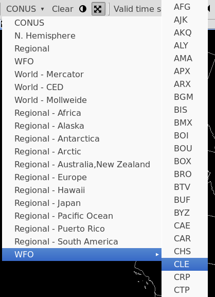
The first toolbar menu item is a dropdown menu for different geographic areas and map projections. The efault view is always CONUS, which is a North Polar Steregraphic projection centered on the Continental United States.
Default projections and areas available in the menu
- N. Hemisphere (North Polar Stereographic)
- Regional (for the selected localization site)
- WFO (for the selected localization site)
- World Mercator
- World CED
- World Mollweide
- Geostationary (GOES East Full Disk)
- and Regional Mercator projections for Africa, Australia/NZ, South America, Europe, Alaska, Hawaii, Puerto Rico, Japan, Pacific Ocean, and the north and south poles.
There is also a WFO submenu which contains a map scale for every NWS localization site.
New Map Editor / View
File > New Map
Opens a new map editor tab with the default projection (CONUS Polar Stereographic).
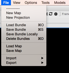
This can also be done by right-click on any tab and selecting New Editor
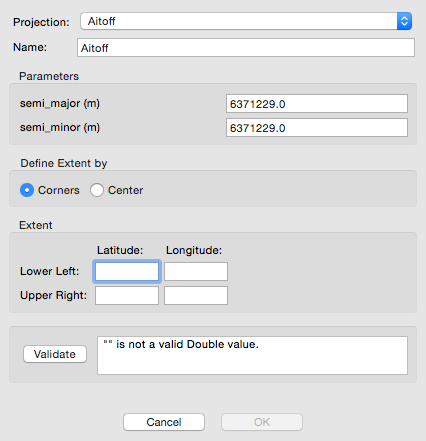
New Projection
File > New Projection
Create a new map projection.