-added the initial header (#) at the top of the file to be consistent with other .md files

Changes to Bundles and Projections page:
-added the initial header (#) to be consistent with other .md files
-removed instances of ">" and replaced them with ">" for easier readability and to be consistent with other .md files
-fixed misspelling in opening description ('a' > 'as')
-updated the subsection headings to match the file menu options in CAVE
-updated the first screenshot for deleting bundles to be consistent with how CAVE currently looks
-update text referring to menu items to match CAVE
1.5 KiB
1.5 KiB
Maps, Views, Projections
Default Map Scales
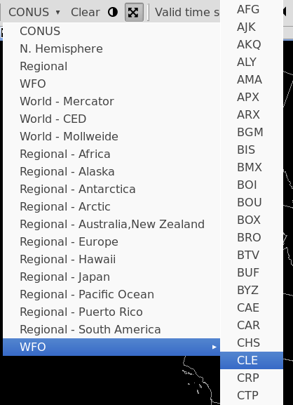
The first toolbar menu item is a dropdown menu for different geographic areas and map projections. The default view is always CONUS, which is a North Polar Steregraphic projection centered on the Continental United States.
Default projections and areas available in the menu
- CONUS
- N. Hemisphere (North Polar Stereographic)
- Regional (for the selected localization site)
- WFO (for the selected localization site)
- World - Mercator
- World - CED
- World - Mollweide
- GOES East Full Disk (Geostationary)
- GOES West Full Disk (Geostationary)
- Regional Mercator projections for
- Africa
- Alaska
- Antarctica
- Arctic
- Australia,New Zealand
- Europe
- Hawaii
- Japan
- Pacific Ocean
- Puerto Rico
- South America
- WFO (Has a submenu which contains a map scale for every NWS localization site)
New Map Editor / View
File > New Map
Opens a new map editor tab with the default projection (CONUS Polar Stereographic).
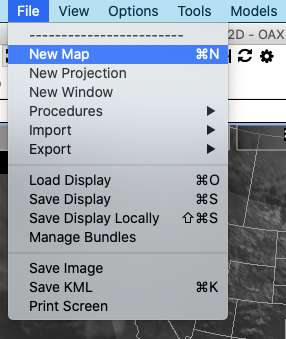
This can also be done by right-click on any tab and selecting New Editor
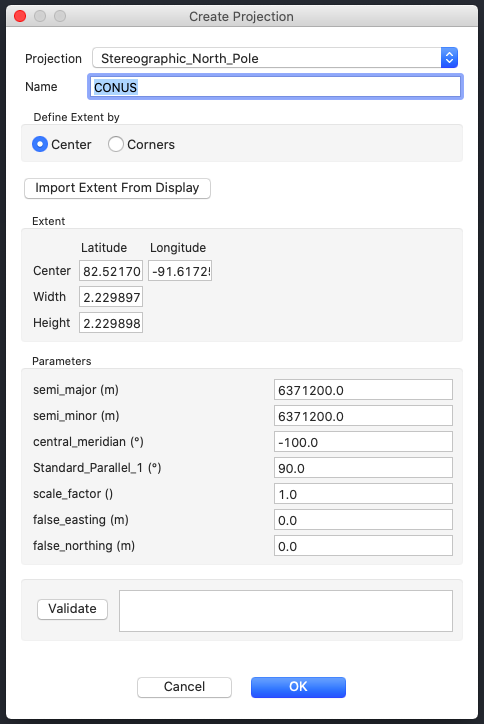
New Projection
File > New Projection
Create a new map projection.