WWAResourceData - Simplified the constructResource to always create and return a WarningsResource - the actual implementation of the constructResource method doesn't quite align with how it originally seemed to be designed. None of the data is actually in the PluginDataObject at this point, all the data is in the LoadProperties. Because of that, differentiating between WatchResources and WarningResources doesn't work the way you would think it does. You end up going through this method once, for the entire load of the WWAs. Also, for some reason the way the WatchResource populated and eventually passed on its records for drawing, actually eliminated the watches. So, by using the WarningsResource class all the time, all the watches, warnings, and advisories are persisted. WarningsResource - the proper convention is for watches to show up as a shaded (thatched) area, and the warnings and advisories to show up with an outline - in the initShape method, look to see what the significance of the record is, and if it's a watch, then create and set the shadedShape (logic taken from the WatchesResource), otherwise create and set the wireframeShape |
||
|---|---|---|
| .github/workflows | ||
| build | ||
| cave | ||
| dist | ||
| docs | ||
| edexOsgi | ||
| javaUtilities | ||
| localization | ||
| pythonPackages/pypies | ||
| rpms | ||
| tests | ||
| .gitignore | ||
| awips_install.sh | ||
| environment.yml | ||
| FOSS_COTS_License.pdf | ||
| LICENSE | ||
| mkdocs.yml | ||
| README.md | ||
Unidata AWIPS
https://www.unidata.ucar.edu/software/awips/


The Advanced Weather Interactive Processing System (AWIPS) is a meteorological software package. It is used for decoding, displaying, and analyzing data, and was originally developed for the National Weather Service (NWS) by Raytheon. There is a division here at UCAR called the Unidata Program Center (UCP) which develops and supports a modified non-operational version of AWIPS for use in research and education by UCAR member institutions. This is released as open source software, free to download and use by anyone.
AWIPS takes a unified approach to data ingest, where most data ingested into the system comes through the LDM client pulling data feeds from the Unidata IDD. Various raw data and product files (netCDF, grib, BUFR, ASCII text, gini, AREA) are decoded and stored as HDF5 files and Postgres metadata by EDEX, which serves products and data over http.
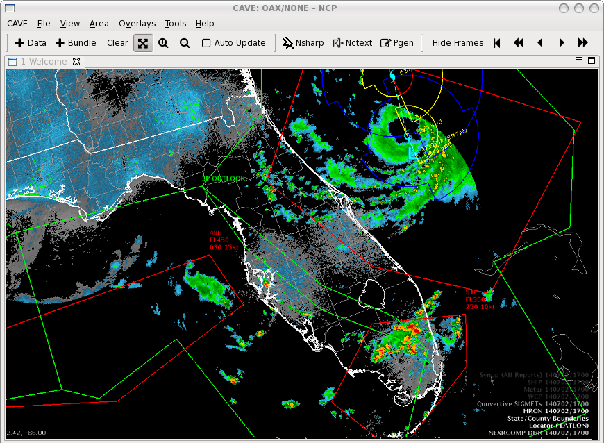
Unidata supports two data visualization frameworks: CAVE (an Eclipse-built Java application which runs on Linux, Mac, and Windows), and python-awips (a python package).
Note
: Our version of CAVE is a non-operational version. It does not support some features of NWS AWIPS. Warnings and alerts cannot be issued from Unidata's CAVE. Additional functionality may not be available as well.
License
Unidata AWIPS source code and binaries (RPMs) are considered to be in the public domain, meaning there are no restrictions on any download, modification, or distribution in any form (original or modified). Unidata AWIPS license information can be found here.
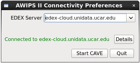
AWIPS Data in the Cloud
Unidata and XSEDE Jetstream have partnered to offer an EDEX data server in the cloud, open to the community. Select the server in the Connectivity Preferences dialog, or enter edex-cloud.unidata.ucar.edu (without http:// before, or :9581/services after).