Maps, Views, Projections
Default Maps
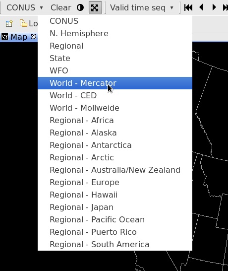
The first toolbar menu item is a dropdown menu for different geographic areas and map projections. The efault view is always CONUS, which is a North Polar Steregraphic projection centered on the Continental United States.
Default projections and areas available in the menu
- N. Hemisphere (North Polar Stereographic)
- Regional (for the selected localization site)
- WFO (for the selected localization site)
- World Mercator
- World CED
- World Mollweide
- and Regional Mercator projections for Africa, Australia/NZ, South America, Europe, Alaska, Hawaii, Puerto Rico, Japan, Pacific Ocean, and the north and south poles.
New Map / New View
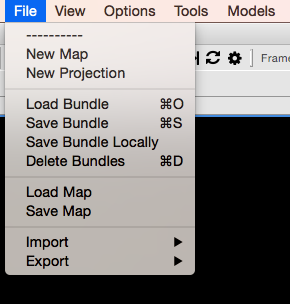
File > New Map
Opens a new map editor tab with the default projection (CONUS Polar Stereographic).
This can also be done by right-click on any tab and selecting New Editor
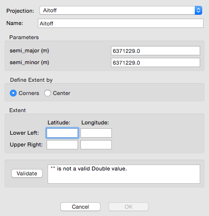
New Projection
File > New Projection
Create a new map projection.
Saving / Loading Bundles
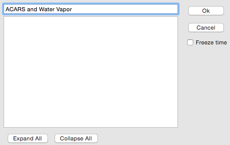
File > Save Bundle
Save a product display within the AWIPS system, synching the bundle between CAVE and the EDEX server.
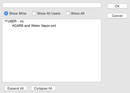
File > Load Bundle
Load a previously-saved bundle from within the AWIPS system.
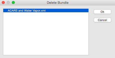
File > Delete Bundle
Select and remove a saved bundle.
File > Load Bundle from Disk
Load a previously-saved display from a path within the file directory of the workstation.
File > Save Bundle to Disk
Save a product display to a path within the file directory of the workstation.
File > Load Map from Disk
Load a map or product display from a path within the file directory of the workstation.
File > Save Map to Disk
Save a map or product display to a path within the file directory of the workstation.
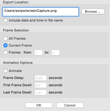
Screenshots
File > Export > Image
which captures a screenshot of the current view
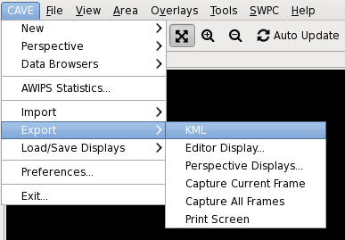
KML
File > Export > KML
The "Export" submenu also includes a "KML" option, which allows users to save D2D displays or GFE grids in the KML (Keyhole Markup Language) file format. When zipped (compressed), the KML file format forms a KMZ file, which can be used in applications such as Google Earth.
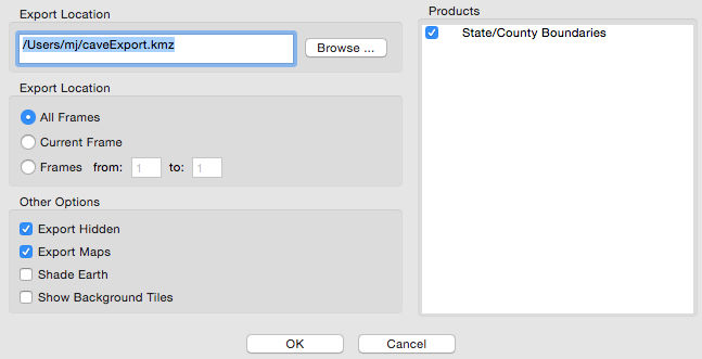
The KML dialog box includes options to select frames to export. This includes exporting all frames, the current/displayed frame, a range of frames, and, in GFE, the selected time range as highlighted in the Grid Manager. Additional options are available for selection under the "Other Options" section:
-
Export Hidden: When selected, all displayed and hidden products listed in the Product Legend section of the Main Display Pane will be exported.
-
Export Maps: When selected, all enabled maps displayed within the Main Display Pane will be exported.
-
Shade Earth: When selected, a shaded background is applied to the exported product. If loaded in Google Earth, the earth will be overlaid with a black backdrop, and data will be displayed as it would in D2D with a black background.
-
Show Background Tiles: When selected, data (such as plot data) will display on top of black tiles when loaded in Google Earth.
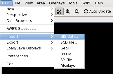
CAVE Import Formats
CAVE supported the following geo-referenced data files. CAVE can import the following through formats through the CAVE -> Import menu.
-
GIS Data
-
BCD File
-
GeoTIFF
-
LPI File
-
SPI File
-
Displays
CAVE Export Formats
CAVE can export to the following through the CAVE -> Export menu.
-
KML
-
Editor Display
-
Perspective Display
-
Capture Current Frame
-
Capture All Frames
-
Print Screen